|
Daily application
 |
|
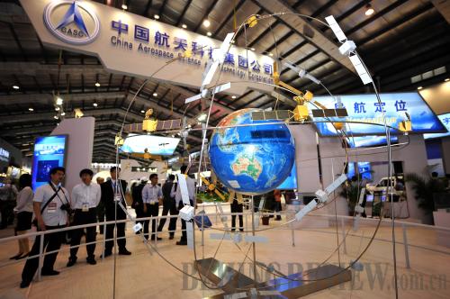
ON SHOW: The model of the Beidou Satellite Navigation System is displayed at the Eighth China International Aviation and Aerospace Exhibition in Zhuhai, Guangdong Province, in November 2010 (XINHUA) |
Today, the Beidou 1 System is widely used in various fields, such as mapping, telecommunication, water conservancy, fishery, transportation, disaster relief and national security.
Many fishery departments have begun to use the Beidou system. GPS can only tell the longitude and latitude of a certain spot but when it comes to emergencies at sea, knowing the longitude and latitude is far from enough as the spot is surrounded by sea.
Using the Beidou system, a button has only to be pressed and an alarm in a fishery management department will be triggered, transmitting speed, direction and precise longitude and latitude of the trapped ship to a rescue team within a second, so rescue work can be started as soon as possible. Also, staff on a ship can receive a text message from the Beidou system control center about the location of the nearest ship, information about how long the rescue will take and helpful advice from professionals.
"If there is a typhoon, fishery management departments will inform Beidou system-equipped ships as soon as possible," said Zhao Kangning, Deputy Director of the China Satellite Navigation Positioning Application Management Center.
The application of the Beidou system in people's daily life is partly attributed to government support. With preferential policies and subsidies, Beidou terminals have been applied along China's 18,000-km coast. Market models have also been constructed.
"The precise positioning of the Beidou system can also be used for land and farmland management, which allows precise cultivation of farmland conducted by agricultural machinery," said academician Liu Jingnan, another executive chairman of 2011 CSNC. "Also, it can monitor tiny changes in large-scale projects, such as the construction of bridges and dams."
"After the completion of the Beidou global system, civil applications will account for 95 percent of the total applications," said academician Sun Jiadong, chief designer of the Beidou Satellite Navigation System Project.
"China has put great emphasis on developing and promoting user terminals of the Beidou system. Many domestic manufacturers are now making efforts to develop portable and convenient user terminal equipment," said Li.
Global use
The building of the Beidou system has been divided into three steps. The goals of the first step have already been achieved. From 2000-03, China launched three Beidou satellites and built an experimental navigation system, becoming the third country in the world to develop a satellite navigation system after the United States and Russia. The second step is to build a network of satellites. More than 10 satellites will be launched into three orbits by 2012, which will provide services such as navigation, positioning and timing for the Asia-Pacific region. The third step aims to build a global satellite navigation system by around 2020 with five geostationary orbit satellites and 30 non-geostationary orbit satellites, to provide passive global location services.
As an important part of the Global Navigation Satellite System—which consists of GPS from the United States, GLONASS from Russia, Galileo from Europe and Beidou from China—the Beidou system also monitors global tectonic plate movements, which is the most important way to predict earthquakes.
"The Beidou system is not only the Chinese people's Beidou but the world's Beidou. It is making a contribution to the world," said academician Yang. "Beidou has helped add greater precision, stability and reliability to the global navigation system."
"In an attempt for greater global application, the Beidou system is also making efforts to improve its compatibility," said Xie Jun, chief designer of the satellite system of the Beidou system. "Great compatibility will give Beidou users many advantages as they will be able to receive information from different kinds of navigation satellites with higher precision. Another benefit of higher compatibility is the full use of space resources." |