|
 |
|
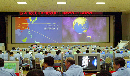
BACKUP: The control center at the Xichang Satellite Launch Center in Sichuan Province after the third Beidou satellite was launched on May 25, 2003 (LI GANG) |
Using the system, taxi companies can keep a nationwide inventory of their assets and past records of their routes. "GPS only locates the taxi that is equipped with the system. If the boss wants to see where the taxi is, the GPS fails. But the Beidou system can provide the service for the boss to see all the locations of the taxies and their routes within defined time period," said Fan.
Twin-satellite system
Beidou's primary innovation is that it uses two satellites to provide navigation and positioning where it should need four.
Positioning using the two satellites can be done by calculating the radius of the Earth and other distances, said Chen Fangyun, one of the creators of the State Hi-Tech Development Plan, in 1983. The next year a team of scientists proved Chen's theory by completing numerous calculations.
In 1986, a positioning and communication system project based on two satellites was approved by the country. In 1989 researchers held the first demonstration of what they thought the system could do. In January 1994, the project was renamed to the Beidou system and was approved to be started.
"We won't cease the first generation of the system to develop the second generation," noted Fan. They would upgrade the system by increasing the number of the satellites and their functions. Fan said the communication function of the first generation laid a solid foundation for the next generation technology. He also said that one of the Beidou 1 backup satellites was installed with a laser reflector, which could accurately locate a user within centimeters.
The Beidou system is based on a Dongfanghong 3 (DFH 3) geostationary communications satellite platform. And now the 71-year-old Fan was right the chief designer of this kind of homemade satellite during that time.
Fan witnessed the send-off of the Dongfanghong 2 (DFH 2) satellite on April 8, 1984, but he was not satisfied with the success. "At the time, other countries had advanced satellite TV broadcast technology while our satellite could only be used for communications."
Fan proposed that DFH 2 should be renovated within a year to be able to broadcast satellite TV. In 1986, an upgraded DFH 2 satellite was launched and thousands of satellite television ground receiving stations were built. Chinese citizens were finally able to watch satellite TV.
In the mid 1980s, two camps developed—one that wanted to buy existing technology, and another that wanted China to develop its own geostationary positioning satellite. Those supporting buying already developed technology held that the DFH 2A satellite had only four transmitters and its technology was not state of the art. There was only a technology consistency rate of 20 to 30 percent to develop DFH 3 satellite on the basis of the previous satellite. The technology consistency rate to develop satellites in foreign countries was 70 percent. The lower consistency rate, the higher risk there is.
But Fan and his colleagues made one breakthrough after another, starting from single small parts and evolving systematic plans that incorporated imported technologies and international cooperation.
On November 30, 1994, a DFH 3 satellite was launched but failed to reach the designated position due to a fuel leak. A group of experts were assembled to figure out the problem. After rounds of trials and errors and experiments, they found the reason for the accident. Another DFH 3 satellite was sent into space on May 12, 1997, made it to the correct position after several days of maneuvering into its orbit.
Domestic producers
In 2008, the Shanghai Fukong Hualong Micro-System Technology Co. Ltd. unveiled the country's first domestically produced navigation chip that is expected to lie at the heart of China's satellite-based navigation system. The company expects the chip to be used for two-way satellite signals and to gradually replace foreign chips on the domestic market.
The accuracy of navigation and positioning systems rely a great deal on the quality of the navigation chips. The chips are only less important than atomic clocks onboard the satellites, which dictate the reliability of the information the system produces.
It took developers tens of millions of yuan and almost three years to develop the chip. It is still a first-generation product and research for its second generation is already underway. |