|
 |
|
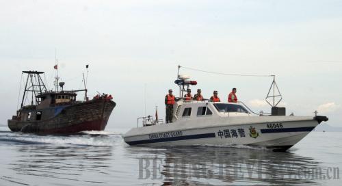
GUARDING THE SEA: A Chinese coast guard vessel escorts a fishing boat in the South China Sea near Sanya in Hainan Province on May 16 (SHI LEI) |

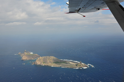
In recent years, there has been heated debate on China's claims in the South China Sea in international media. Despite massive support for these claims, suspicions are still being harbored. China's stance, they say, is not in line with the UN Convention on the Law of the Sea (UNCLOS). This accusation is groundless. China's claims in the South China Sea, including the sovereignty of the Nansha Islands and the jurisdiction of waters surrounding those islands, are based on historical facts and legal validity, and also have been recognized by many other countries.
The UNCLOS, which was signed in 1982 and came into force in 1994, defines the rights and responsibilities of nations in their use of the world's oceans. The National People's Congress, China's top legislature, ratified the convention in 1996. China's claims to the territory in the South China Sea are not something new according to the UNCLOS, which can by no means be used as the legal base for discussing sovereignty of islands in general legal terms. From the historical viewpoint, the claims were made by various Chinese feudal dynasties and modern governments in succession.
A matter of fact
China was the first country to discover, use and manage the islands in the South China Sea and possesses the most sufficient historical evidence. A large number of ancient Chinese records such as books, maps and official documents contain references to Chinese people's knowledge and actual use of the South China Sea.
China has exercised jurisdiction over the South China Sea islands throughout history. In the mid-19th century, the Chinese Government began to send military and civilian officials to the islands to erect boundary markers, raise flags and fire guns to demonstrate sovereignty.
Successive governments in China also included the islands in their vast domain and marked them on various official maps. There were many cases that showed Chinese governments had granted permits to businessmen and fishermen to work on the islands, protested against foreign invasion of some of the islands and established administrative agencies to govern the islands in the South China Sea.
Among all the countries around the South China Sea, China is the only country to have exercised continuous and effective jurisdiction over the islands for hundreds of years.
Take the naming of the islands, for example. China named the islands several times, including in 1909, 1935, 1947 and 1983. This is a concrete proof of jurisdiction.
The line of demarcation in the South China Sea serves as further proof. Historical documents clearly show the dotted line, also named as the U-shape line by scholars, in the South China Sea appeared no later than 1914 on privately published maps of China. The Chinese Government confirmed the line in 1947 and marked it on official maps published in the next year.
After the People's Republic of China was founded in 1949, this line was largely maintained. The government adjusted the dotted line and published it in official maps in 1962. The line has been in use to this day. It is recognized, either publicly or tacitly, by countries including Viet Nam. It is also marked out on maps published by countries such as Viet Nam, France and Japan.
The dotted line demarcating the South China Sea emerged long before the UNCLOS. It is by no means a new proposal or new demand made by the Chinese Government after the adoption of the convention. Viet Nam also says it has historical instruments to support its claims to the islands. But Chinese historical scholars have pointed out the mistakes in Viet Nam's so-called ancient documents.
Other coastal states of the South China Sea claimed sovereignty over all or parts of the Nansha Islands based only on the regime of the 200-nautical-mile Exclusive Economic Zone of the UNCLOS. These claims are surely illegal. Additionally, according to bilateral treaties or national legislations that demarcated the scopes of territorial sovereignty of other coastal states of the South China Sea, the Nansha Islands were excluded.
It has been nearly a century since China first used the dotted line on its maps. The Chinese Government officially released the line 63 years ago, 46 years before the UNCLOS took effect.
|