
|
| Xinjiang Today |
| Survival wisdom of oasis settlements | |
|
|
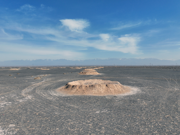 The ruins of a Karez well system in Yizhou District, Hami, on March 31, 2024 (CNSPHOTO)
Karez wells—ancient irrigation works preserved in the Tulufan (Turpan) Basin of Xinjiang—are known as the lifelines of the desert. Together with the Great Wall and the Beijing-Hangzhou Grand Canal, they are hailed as one of "the three great engineering feats of ancient China" and are also referred to as the "underground Great Wall."
More than just a testament to ancient craftsmanship, Karez wells stand as a brilliant example of how people of Xinjiang achieved harmony with nature despite the extremely arid environment. On September 3, 2024, Karez wells were inscribed on the World Heritage Irrigation Structures list at the 75th International Executive Council Meeting of the International Commission on Irrigation and Drainage. This honor has once again turned the world's gaze to this "underground river" that has flowed for millennia. 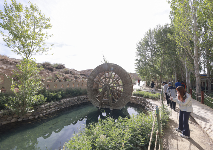 Tourists visit a Karez well irrigation system in Hami on May 25 (CNSPHOTO)
Historical origins The origins of Karez wells remain a subject of academic debate, with no definitive conclusion yet reached. The most prominent hypothesis suggests an indigenous origin. Archaeologists have discovered rock art in Tuokexun (Toksun) County, Tulufan, estimated to be about 2,300 years old, depicting water systems, wells and springs that closely resemble Karez structures. These are considered strong physical evidence left by ancient inhabitants. In addition, scientific dating has determined that the oldest existing Karez well in the area was built about 600 years ago in the early Ming Dynasty (1368-1644). An alternative argument, however, is that the engineering technique was introduced from the Central Plains, the heartland of ancient China that covers the middle and lower reaches of the Yellow River. This view holds that Karez wells were inspired by the well-shaft method. According to Western Han-Dynasty (206 B.C.-A.D. 25) historian and writer Sima Qian's Records of the Grand Historian, China's first comprehensive historical work, the method was used in constructing the Longshou Canal in present-day Shaanxi Province around 128 B.C. The text records that workers sunk wells, the deepest over 40 zhang (about 90 meters today), spaced at intervals and connected by underground passages for water flow. This ingenious system of vertical shafts and underground channels later made its way to Xinjiang, then known as the Western Regions. This theory is supported by key historical records. According to the Biographies of Dawan in the Records of the Grand Historian, during the reign of Emperor Xuandi, spanning from 74 to 49 B.C., when the ancient town of Dawan was besieged, people from the Central Plains were found inside the town teaching well-digging techniques, resolving a water crisis. This indicates that the well-shaft method had already reached the Western Regions by that time. Wang Guowei, a prominent scholar in the early 20th century, considered this evidence of the westward transmission of Karez wells. A third theory maintains that Karez wells originated in Persia (modern-day Iran) and later spread along the ancient Silk Road into Xinjiang. Its strongest support is linguistic: The Uygur term for the wells, kariz, shares the exact pronunciation as the Persian word karez. Additionally, Persian Karez wells can be traced back to as early as 1000 B.C., with the oldest surviving example found in Yazd, Iran, dating back about 3,000 years. Some historians therefore believe that with the expansion of the Persian Empire and the flourishing of Silk Road trade, the Karez water system reached Kashi (Kashgar) and Tulufan areas of Xinjiang from Central Asia. 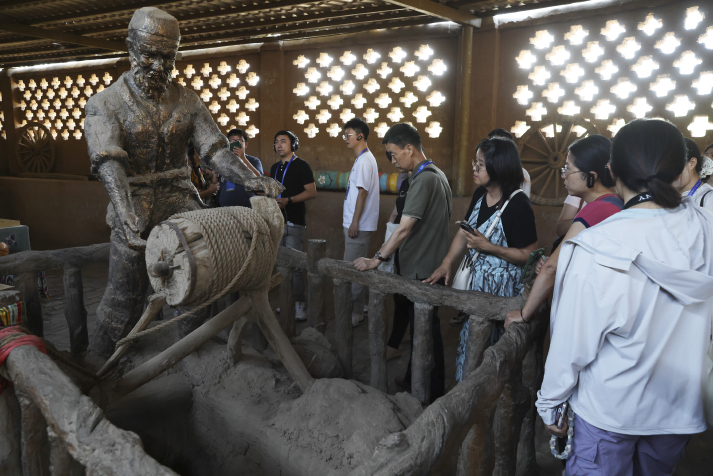 Visitors at a museum of Karez wells in Tulufan on September 10, 2025 (CNSPHOTO)
Adapting to nature Regardless of its origins, one fact remains unchanged: Karez wells are a great achievement in humanity's harnessing of nature. They embody the survival wisdom of the local people in water resource management and oasis settlements in desert regions. The Tulufan Basin is bordered by the Bogda Peak, the highest summit in the eastern section of the Tianshan Mountains, to the north and the Karcawuquntag Mountains to the west. In spring and summer, large amounts of snow and glacial meltwater flow down from the mountains. However, because the basin's surface is mostly gravel with high permeability, most of the water seeps underground as it flows into the basin, forming abundant groundwater flow. How to effectively utilize these precious resources became a survival challenge that local ancestors had to solve. It was precisely under these extreme arid conditions with high evaporation rates that Karez wells came into being. They cleverly utilized the topographic gradient of the Tulufan Basin—higher in the north and lower in the south—to channel snowmelt and glacial water from higher elevations through underground channels to oasis farmlands at lower elevations by gravity flow, requiring no power equipment whatsoever. This design not only overcame the lack of water-lifting devices but, more importantly, buried the water conveyance channels deep underground, minimizing evaporation losses to the greatest extent—a true model of "borrowing water from underground." Such wisdom runs throughout Xinjiang's history. According to the Biography of the Western Regions in the Book of Han, the official chronicle of the Western Han Dynasty from 206 B.C. to A.D. 23, the central authorities stationed troops and cultivated farmland in places such as Luntai and Quli in 101 B.C., with the irrigation area exceeding 5,000 qing (about today's 23,000 hectares) decades later. According to contract documents unearthed from the Astana Cemetery in Tulufan—which consists of more than 500 ancient tombs that have survived from the third to eighth centuries—Xinjiang had already developed an extensive network of waterways during the Tang Dynasty (618-907). In addition, an annual maintenance system was established for engineering works. Tang soldiers, together with surrendered Turkic tribes, jointly dredged the Weigan River, the Kuqa River and other tributaries, and officials were appointed to manage water sluice gates at key sections. Military agrarian settlements upstream were given priority for irrigation, while civilian fields downstream received water allocations according to need. The Veritable Records of the Qing Dynasty (1644-1911), compiled and edited primary historical sources for Qing history, states that in 1761, the Yanqi irrigation area "added and repaired gate structures, following the style of the Central Plains, installing wooden planks for opening and closing." In Yeerqiang (Yarkant) and other places, officials known as "Mirab Beg" were specially appointed to manage ditch and canal irrigation affairs, with established management regulations and penalty provisions. The Gazetteer of Xinjiang, compiled between 1910 and 1911, records that by the late years of Emperor Guangxu's reign (1875-1908), Xinjiang had 944 main canals and 2,333 branch canals, with an irrigation area exceeding 700,000 hectares—reflecting the great achievements in local water conservancy construction. Exquisite water conservancy system A complete Karez well system consists of vertical shafts, underground channels, surface channels and storage ponds. Each component serves a specific purpose, collectively forming an efficient and stable underground water conservancy network. Vertical shafts are passages used for positioning, soil removal, ventilation, and inspection and maintenance during the excavation or cleaning of underground channels. The depth of the shafts varies according to terrain and groundwater levels, being deepest near the water source, reaching over 90 meters and even up to 120 meters. These structures are typically spaced 20 to 70 meters apart, with each well containing anywhere from a dozen to over 100. The ring-shaped mounds of earth piled around the shaft openings, formed from excavated soil deposited nearby, serve both to prevent windblown sand and floodwater from entering the well and to protect water quality. Underground channels are the core of the entire system. Buried several to dozens of meters underground, they are divided into two parts: The lower section, situated below the water table, collects groundwater, while the upper section transports it to the surface. The length of underground channels ranges from tens of meters to over 10 km. In the Tulufan area, the total length of these channels once exceeded 5,000 km. It is this deep-hidden waterway that allows snowmelt and glacial water to traverse the Gobi Desert and reach farmlands and villages with nearly zero loss. In an era lacking modern surveying tools, craftsmen used wooden-stick or the oil-lamp alignment to ensure the underground channels were dug in a straight direction. The principle of oil-lamp alignment is based on the fact that two points determine a line, using two oil lamps with spouts on their sides to determine the digging direction. When digging an underground channel, a lamp was hung on the centerline of the shaft. With their back to the lamp, the excavator would dig toward their own shadow, thus never deviating from the direction. These traditional methods fully demonstrate the wisdom of ancient workers. Surface channels are above-ground canals that transport water from the outlet to storage ponds or farmlands, typically stretching 100 to 500 meters in length. The outlet is the junction between the underground and surface channels—the first point where groundwater reaches the surface. The storage ponds are small reservoirs located at the end of the surface channels, used for regulating water flow, storing water for irrigation and improving the local ecology. Often shaded by lush trees, they attract wildlife and act as communal gathering places for the villagers. The Karez well system utilizes the natural terrain gradient to achieve gravity-fed irrigation without any additional power source. This feature made it the perfect irrigation solution in an era without electricity or machinery. Moreover, those wells are minimally affected by seasonal changes, with stable flow rates that provide reliable support for agricultural production. Karez wells have endured for a millennium in Tulufan because of their remarkable advantages in arid environments: Tulufan has high temperatures and intense evaporation, yet the Karez's underground channels greatly reduce water evaporation. This is the core design principle of the irrigation system and the key measure for coping with extreme arid conditions. Cornerstone of oasis civilization Unlike many ancient irrigation works that have long become ruins, Karez wells continue to nourish the oases of Tulufan to this day. They are the lifeline of local agriculture. Before the advent of Karez wells, agricultural production in the area was severely constrained by water scarcity. The innovative irrigation system brought groundwater to the surface, transforming previously barren Gobi lands into a land of melons and fruits. Tulufan's grapes, Hami melons and other renowned agricultural products could thereafter be cultivated at scale, forming a unique oasis agricultural system. To date, 1,540 Karez wells have been documented in Xinjiang. Some 1,200 wells are in Tulufan, of which nearly 190 remain active. They generate an annual runoff of 114 million cubic meters, supporting irrigation across more than 6,660 hectares. These figures fully demonstrate the central role of Karez wells in agricultural production. Karez wells are not merely irrigation works; they are also a driving force for social development. A reliable water supply allowed populations to gather, creating settlements around these wells. In the Tulufan Basin, the names of many villages are associated with Karez wells. The construction and management of Karez wells also gave rise to unique social organizations. Today, each Karez well has dedicated managers responsible for maintenance, de-silting and water allocation. This collective cooperation mechanism has strengthened community cohesion and fostered a social tradition of "shared water rights and joint maintenance." The transmission of Karez knowledge between families and generations has fostered a distinctive culture of craftsmanship. Karez wells are also rich in cultural connotations. From their excavation techniques to management practices, along with the folk tales to artistic works they have inspired, they are deeply woven into the cultural fabric of local communities. In 2014, the excavation techniques were inscribed on the national list of intangible cultural heritage items. As a living cultural heritage, Karez wells embody low-carbon, sustainable water management principles that resonate strongly with today's pursuit of harmonious coexistence between humans and nature. In an era of global warming and increasingly severe water shortages, the ecological wisdom embodied in these wells holds great inspirational value for the present day. Comments to lanxinzhen@cicgamericas.com |
|
||||||||||||||||||||||||||||
|