|
| Xinjiang Today |
| A Qing Dynasty work and its enduring value | |
|
|
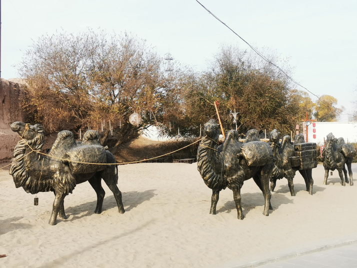 Camel sculptures at the ruins of the Qing Dynasty (1644-1911) town of Kuche (Kucha or Kuqa) in Kuche, Aksu Prefecture, in November 2024 (VCG)
Xu Song (1781-1848) stands as a pivotal figure in Qing Dynasty (1644-1911) studies of the historical geography of China's northwestern frontier. His turbulent official career culminated in exile, an experience that paradoxically enabled extensive travel and field investigation, proudly shaping his geographical writings. Over the course of seven years, Xu compiled the Records of Waterways in the Western Regions, organizing the vast frontier landscape according to river systems and using waterways as the structural framework of the text. The work provided 19th-century China—and the wider world—with some of the most comprehensive geographical and ethnographic documentation of the area. More than two centuries later, it remains a vital source for the historiography of Xinjiang. The Western Regions are regions west of the Central Plains—a vast area covering the lower and middle reaches of the Yellow River and considered the heartland of ancient China—including today's Xinjiang. 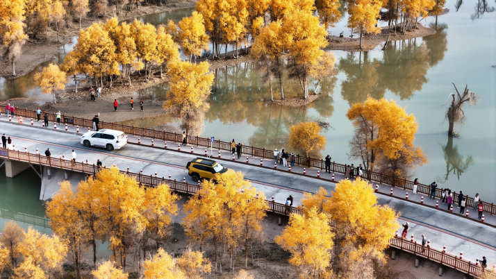 A desert poplar forest along the Tarim River in Luntai County, Bayingolin Mongolian Autonomous Prefecture, in October 2025 (VCG)
From exile to explorer Xu's exile to the Western Regions followed an abrupt political downfall. Born into an official family, he served as a compiler at the Imperial Academy and later as education commissioner in Hunan, earning a strong reputation among scholars in the capital. In 1812, however, he was dismissed from office and exiled to Yili (Ili) for violating an imperial decree during his tenure in Hunan. Rather than yielding to despair, Xu transformed exile into scholarly opportunity. Upon arriving in Yili, he quickly adapted to local conditions. At the time, Song Yun, who served as Yili General, a post established in 1762 to exercise unified military and administrative jurisdiction over the regions both south and north of the Tianshan Mountains, was seeking to compile a comprehensive gazetteer of the vast land. Impressed by Xu's learning and administrative experience, Song enlisted him to assist with the compilation of the work later titled Summarized Records of Xinjiang by Emperor Daoguang, who reigned from 1820 to 1850. This appointment granted Xu exceptional scope for fieldwork. With official backing, he was able to travel extensively, laying the groundwork for a systemic survey of the Western Regions. Xu's travels ranged across both the northern and southern slopes of the Tianshan Mountains, from the areas east and south of Lake Balkhash, now in Kazakhstan, to the shores of Lop Nor lake, and from the margins of the Taklimakan Desert to the eastern foothills of the Pamirs. His approach blended careful measurement with direct observation and inquiry. In pursuit of more detailed evidence, Xu crossed the Musuer Ridge at the height of winter, braving extreme conditions at a pass more than 7,000 meters above sea level. Amid bitter cold and deep snow, he recorded the striking sight that "ice at times encased horse bones, and even held boulders as large as houses," and argued, on the basis of textual comparison, that this ridge was the Lingshan described by the Tang Dynasty (618-907) monk Xuanzang, who traveled from China to India to obtain sacred Buddhist scriptures. In the Lop Nor region, he battled sand-laden winds to trace hydrological changes and map the distribution of oasis settlements. By integrating in-depth textual studies with intensive fieldwork investigation, he assembled firsthand materials far exceeding those preserved in earlier sources, laying a solid foundation for his later compilation. 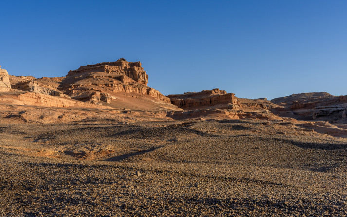 A yardang landform in Lop Nor, Ruoqiang County, Bayingolin Mongolian Autonomous Prefecture, in September 2025 (VCG)
Methodological innovation and editorial achievement In 1819, as his exile drew to a close, Xu completed the Records of Waterways in the Western Regions. The work comprises five volumes accompanied by waterway maps, tracing the geography and history of the Western Regions through the lens of hydrology. Its most distinctive contribution lies in its method of organization and classification. Xu observed that, in this landlocked environment, most rivers were endorheic, ultimately flowing into terminal lakes. Accordingly, he organized the region's waterways into 11 lake-centered drainage systems, each structured around a major body of water—including Lop Nor, Balkhash and the Sayram Lake. For each system, he documented river sources and courses, points of confluence and bifurcation and the topography of the surrounding basin. Grounded in physical geography rather than administrative divisions, this approach departed decisively from traditional gazetteer models and marked a major advance in Chinese geographical studies. As Xu traced river courses and hydrological features, he drew extensively from textual sources to conduct extensive research on administrative change, population movement, military and civil institutions and the distribution of major sites within each drainage basin. Yet the work was far more than a technical survey. Alongside precise measurements of river length, drainage area and irrigation use, it incorporates substantial historical and cultural heritages. In the Qiuci region on the southern foot of the Tianshan Mountains, for example, Xu produced one of the earliest systematic accounts of the Kizil Caves in today's Baicheng County, Aksu Prefecture. These are among the earliest Buddhist cave complexes in China. The Records of Waterways in the Western Regions achieved a great deal of scientific precision unprecedented in its time. Many entries record latitude and longitude alongside measured distances. Xu also paid close attention to the natural environment, documenting distinctive flora and fauna of the Western Regions. These observations now constitute valuable evidence for reconstructing local ecological conditions and environmental change in the Qing Dynasty. In 1820, Xu returned to Beijing, where his work quickly gained recognition as an authoritative reference on the Western Regions. Emperor Daoguang, impressed by its scope and rigor, grouped it with two of Xu's other works—the Xinjiang Fu and Supplementary Notes of Hanshu Xiyuzhuan—designating the trio as the "Three Works on the Western Regions" and entering them into the court's standard reference library for frontier governance. Historical value The Records of Waterways in the Western Regions laid the groundwork for Qing Dynasty studies on the northwestern frontier's historical geography. Its influence soon extended far beyond China. From the late 19th century onward, foreign sinologists and explorers relied on it as a key source for their research on the Western Regions. Manuscript copies preserved in major institutions—including the National Library of China, Waseda University Library in Japan and the National Library of Russia—attest to its status as a shared resource for international scholars. For contemporary Xinjiang, the work retains significance in multiple levels. Inherently interdisciplinary, it weaves together geography, history, ethnography and military strategy. The text offers vivid portrayals of daily life and custom among the region's peoples—from scenes of religious instruction in south Xinjiang's "Muslim villages," where residents reportedly "rode donkeys in pairs and, seated in the saddle, recited the classics," to observations on Kazak pastoral nomadism in the north. Xu also documented the Qing military-administrative order, detailing the jurisdiction of the Yili General, the network of military outposts and watchtowers, and the water-control infrastructure supporting tuntian (garrison farming) zones. Comprehensive and richly detailed, the work transcends the bounds of geographical treatise, serving as a vital source for studying Qing Dynasty frontier governance and long-term patterns of multiethnic interaction and integration. The text continues to serve contemporary research in multiple fields. Its records of shifting river courses and changing lake levels provide a crucial baseline for reconstructing ecological change in Xinjiang. Additionally, it offers detailed evidence on Qing Dynasty development, interethnic contact and integration, and military-administrative system in the Western Regions, illuminating how a multiethnic China gradually took shape. Liu Tao, a professor at Xinjiang Arts University, has devoted many years to producing an annotated translation of the Records of Waterways in the Western Regions. By rendering dense classical prose into clear modern Chinese and identifying historical toponyms with their modern counterparts, he has brought this classic back into active circulation, reaffirming its relevance across time and space. Though sent into exile, Xu traversed the frontier on foot, transforming lived experience into an enduring scholarly legacy. The labor crowned his intellectual career while bequeathing China an enduring cultural legacy. The Records of Waterways in the Western Regions catalogs rivers and lakes, towns and fortifications, and the communities that thrived around them. Yet it is more than a geographical compendium. It stands as a testament to a scholar's sense of responsibility, the conviction that concern for the fate of the country persists regardless of rank or power. Even today, Xu's account conveys the resilience and resolve with which he crossed the desolate Western Regions. The rivers he documented in these pages sustained oasis societies in antiquity, but their significance lies in how they became a lens through which the region has been understood and governed, anchoring both administrative practice and scholarly study across the centuries. Comments to lanxinzhen@cicgamericas.com |
|
||||||||||||||||||||||||||||
|